

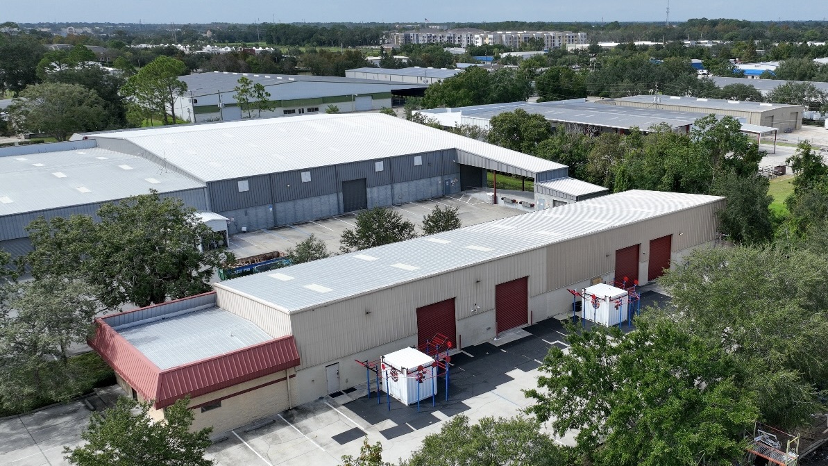
Drone Roof Inspection & Aerial Thermal Survey
Aerial and thermal drone roof inspections in Charlotte, NC. We map trapped moisture on large low-slope roofs without foot traffic, fly under FAA Part 107, and deliver claim-ready
Commercial Roofers Charlotte
Aerial and thermal drone roof inspections in Charlotte, NC. We map trapped moisture on large low-slope roofs without foot traffic, fly under FAA Part 107, and deliver claim-ready documentation.
Drone Roof Inspection & Aerial Thermal Survey work starts with a documented roof walk and ends with a scope owners can use.
A faster, safer way to read a 300,000-square-foot roof Walking a giant distribution roof in the Steele Creek industrial zone the old way takes a two-person crew most of a day, and even then they are reading the membrane from standing height, one bay at a time.
We fly the whole field at a fixed altitude with a high-resolution camera and a calibrated thermal sensor, cover the roof systematically in a fraction of the time, and never put a boot on a membrane whose condition we have not confirmed yet.
On the sprawling low-slope roofs that line Charlotte's logistics corridors out toward the airport and along I-85, that mix of speed, completeness, and zero foot-traffic risk is tough to beat.
It matters most where walking the roof is itself the hazard.
A brittle, aged modified-bitumen roof on a warehouse near the University Research Park, a roof with marginal structural condition, a roof slick after one of our afternoon thunderstorms: in every one of those cases we would rather gather the data from the air first and then send a tech to the handful of spots that genuinely need a hands-on look.
The moisture map is the real deliverable The single most valuable thing a drone survey produces on a commercial roof is a map of where the insulation is wet, and that is a thermal job, not a visual one.
After a clear, hot Charlotte day the entire roof soaks up heat, and once the sun drops the dry areas shed that heat to the night sky quickly while the saturated areas hold onto it.
The membrane can look flawless from overhead and still be hiding a spreading field of saturated insulation underneath.
That map is what turns an inspection into a decision.
It tells us whether you have a few discrete wet zones that can be cut out and patched, or a roof wet across enough of its area that a recover or full replacement is the honest answer.
We confirm every thermal anomaly with a physical core cut at the flagged locations before anyone writes a repair scope, so the moisture map is verified, not assumed.
Why thermal beats a walkover for finding water A thermal pass reads the entire roof during the narrow post-sunset window, while a walking inspector cannot cover a large roof fast enough to catch that window across the whole field.
A faster, safer way to read a 300,000-square-foot roof
Walking a giant distribution roof in the Steele Creek industrial zone the old way takes a two-person crew most of a day, and even then they are reading the membrane from standing height, one bay at a time. Things get missed: shallow ponding that only shows as a faint stain, a hairline split tucked against a curb, the first soft blister in a back corner nobody reaches. Aerial inspection changes that math. We fly the whole field at a fixed altitude with a high-resolution camera and a calibrated thermal sensor, cover the roof systematically in a fraction of the time, and never put a boot on a membrane whose condition we have not confirmed yet. On the sprawling low-slope roofs that line Charlotte's logistics corridors out toward the airport and along I-85, that mix of speed, completeness, and zero foot-traffic risk is tough to beat.
It matters most where walking the roof is itself the hazard. A brittle, aged modified-bitumen roof on a warehouse near the University Research Park, a roof with marginal structural condition, a roof slick after one of our afternoon thunderstorms: in every one of those cases we would rather gather the data from the air first and then send a tech to the handful of spots that genuinely need a hands-on look.
The moisture map is the real deliverable
The single most valuable thing a drone survey produces on a commercial roof is a map of where the insulation is wet, and that is a thermal job, not a visual one. Wet insulation carries more thermal mass than the dry insulation around it. After a clear, hot Charlotte day the entire roof soaks up heat, and once the sun drops the dry areas shed that heat to the night sky quickly while the saturated areas hold onto it. For a window after sunset, the wet zones glow warmer through the infrared camera, and we fly that window to catch them. The membrane can look flawless from overhead and still be hiding a spreading field of saturated insulation underneath.
That map is what turns an inspection into a decision. It tells us whether you have a few discrete wet zones that can be cut out and patched, or a roof wet across enough of its area that a recover or full replacement is the honest answer. We confirm every thermal anomaly with a physical core cut at the flagged locations before anyone writes a repair scope, so the moisture map is verified, not assumed.
Why thermal beats a walkover for finding water
A thermal pass reads the entire roof during the narrow post-sunset window, while a walking inspector cannot cover a large roof fast enough to catch that window across the whole field.
Trapped moisture rarely surfaces, so a visual-only inspection regularly declares a roof healthy while saturated insulation is quietly corroding the steel deck below it.
The map lets us scope a targeted repair instead of defaulting to a tear-off, which on a large Charlotte roof can be the difference between a five-figure repair and a six-figure replacement.
Flying legally over Charlotte's airspace
This is regulated airspace and we fly it that way. Every flight is conducted under FAA Part 107 by a certificated remote pilot. The real wrinkle here is Charlotte Douglas International: a big share of the commercial roofs we inspect in Steele Creek, around the airport, and across the western industrial belt sit inside controlled airspace, where any flight needs an authorization through the FAA's LAANC system, frequently with a hard altitude ceiling. We check the airspace for every address, pull the LAANC authorization where it applies, and plan the flight to stay inside the approved ceiling. On the ground we keep the aircraft within visual line of sight, brief the site, and stay clear of people and active loading docks. The owner does not have to think about any of it; it is built into how we schedule the flight.
Beyond claims: planning and specs
The same aerial data shortens the front end of a reroofing project. Before we write a replacement spec, a drone survey verifies the true roof area, locates and counts every penetration, curb, and drain, and records existing conditions photographically. Specifying off measured conditions instead of guesses cuts the requests-for-information and change orders that pile up when a bidder discovers field conditions nobody documented. For owners managing capital across several Charlotte buildings, a recurring aerial survey is also a clean way to track condition year over year and rank where the next dollars should go.
How does a drone inspection compare to a traditional walkover?
It covers the full roof systematically at a consistent altitude and produces a complete photographic and thermal record, all without the foot traffic that can damage a membrane or create liability on a roof of unknown condition. On large or hard-to-access Charlotte roofs it is faster and more thorough, and it captures moisture data a walkover simply cannot.
Can thermal imaging really show moisture I cannot see?
Yes, under the right conditions. We fly the post-sunset cool-down window, when saturated insulation still holds the day's heat and reads warmer than the dry roof around it. The resulting map is accurate enough to drive a repair-versus-replace decision, and we confirm it with core cuts before specifying anything.
Are you allowed to fly near Charlotte Douglas Airport?
We fly under FAA Part 107 with a certificated remote pilot, and for roofs inside the controlled airspace around Charlotte Douglas we obtain the required LAANC authorization and stay within the approved altitude ceiling. We verify the airspace for every site before scheduling a flight.
How do you use the footage for an insurance claim?
We deliver a GPS-tagged report documenting hail-impact locations and density, wind damage patterns, equipment and flashing damage, and overall membrane condition, formatted for commercial property carriers and ready to hand to an adjuster. For contested claims we can provide a supporting statement based on the documentation.
What kinds of roofs benefit most?
Large low-slope commercial roofs: distribution and industrial buildings, retail centers, office complexes, and multi-building campuses. On any roof over roughly 10,000 square feet where you need a full condition assessment, the aerial-plus-thermal approach is the more efficient and complete choice. Small or steep roofs a crew can inspect quickly by hand benefit less.
Request a Written Scope